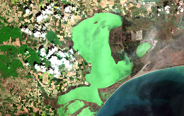
The Danube River flows into the Black Sea through a delta, the second largest and best preserved in Europe. The Danube Delta is a wetland of international importance, being a Natural Heritage Site of global relevance with the status of Biosphere Reserve (UNESCO Man and the Biosphere Programme). The delta is located in the south-eastern part of Romania and south of Ukraine.
The Danube Delta receives inputs from the large catchment of the Danube, the most international river in the world. Preserving its ecosystem, while trying to ensure a sustainable social and economic development of this area, one of the poorest of Europe, requires careful monitoring and management.
CERTO in the Danube Delta
The CERTO project has developed an innovative water quality monitoring system for the complex aquatic environments of the Danube Delta.
Radiometers installed on research vessels measure light reflecting off the water to characterise these optically complex waters. Combined with in situ sampling, satellite data, and historical records, this provides a comprehensive understanding of spatial and seasonal variations in water quality across the delta’s diverse lakes, lagoons, and coastal waters.
This unique database, tailored to the needs of regional users, advances knowledge of the dynamics of these ecosystems. By integrating multiple data sources, CERTO delivers reliable water quality information to address environmental challenges in the Danube Delta and the Black Sea.
Sampling in the Razelm-Sinoe lagoon

Sentinel 2 satellite image of the Razelm lagoon