The Elbe River flows through the German Bight into the North Sea. This region is under pressure from significant human impacts, yet contains sensitive ecosystems like the Wadden Sea, the largest unbroken intertidal wetland system worldwide.
The Port of Hamburg, located 110 km up the Elbe from the North Sea, is the third busiest port in Europe and fifteenth globally. In 2014, it handled 9.73 million TEUs (twenty-foot equivalent units), a standard container shipping measurement. All vessel traffic must transit through the German Bight and Elbe to reach Hamburg.
Balancing intensive port uses, coastal development, and ecosystem preservation in the heavily trafficked Elbe remains an ongoing challenge. Evidence-based management utilising timely and accurate data is essential to protect unique habitats like the UNESCO World Heritage Wadden Sea.
CERTO in the Elbe
CERTO has advanced water quality monitoring in the Elbe Estuary by developing new indicators tailored to this highly dynamic environment. Stakeholder needs drove the development of an indicator for the maximum sediment zone location, which relates strongly to river runoff patterns.
A key CERTO achievement was enhancing optical water type models to better characterise the Elbe’s highly dynamic, turbid waters and expansive intertidal flats. By integrating in situ measurements with satellite data interpretation, CERTO significantly improved monitoring of this complex estuarine environment.
CERTO provides new insights into the Elbe ecosystem, which faces pressures from intensive port traffic and coastal development. The advanced monitoring tools developed through CERTO’s stakeholder-driven approach will help balance economic uses with preservation of fragile ecosystems like the Wadden Sea.
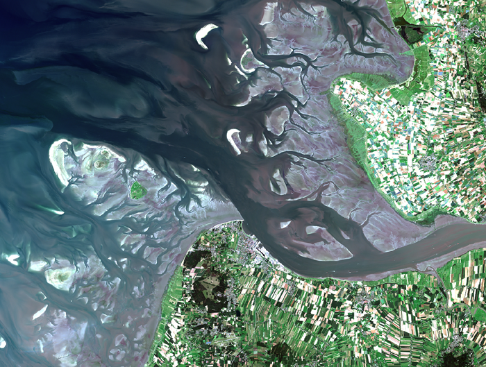 Sentinel 2 satellite image of the Elbe estuary